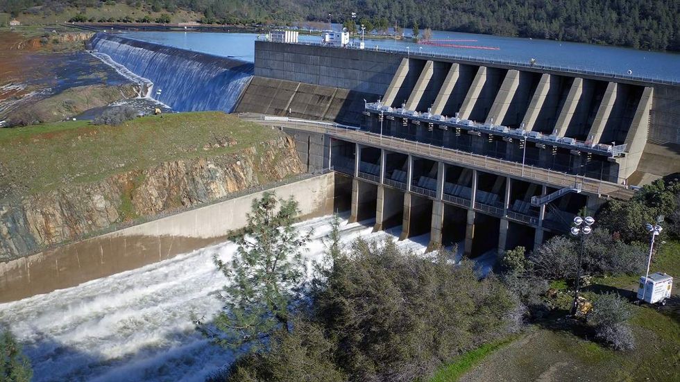
OROVILLE, CA - FEBRUARY 11: In this handout provided by the California Department of Water Resources (pixel.water.ca.gov), This aerial view from a California Department of Water Resources drone shows water flowing from the primary spillway at 55,000 cubic feet per second (cfs) and water from Lake Oroville spilling water over the the auxiliary spillway between 5,000 and 10,000 (cfson February 11, 2017 in Oroville, California. Almost 200,000 people were ordered to evacuate the northern California town after a hole in an emergency spillway in the Oroville Dam threatened to flood the surrounding area. (Photo by Zack Cunningham/ California Department of Water Resources via Getty Images)