Rob Eno
The state of Arizona has Many stunning drives. Routes stretch through the red rocks of Sedona, the mining town of Jerome, the great Hoover Dam, the breathtaking Monument Valley, both rims of the Grand Canyon, and beyond. One of the more spectacular and often overlooked scenic routes is the Apache Trail, and you can make it the crowning part of a day trip starting from the Phoenix area.
We’ll dive into the whole route, but first, let’s briefly introduce the wonder and awe of the Apache Trail. If you combined the twists and turns of the Pacific Coast Highway and put it halfway up the wall of the Grand Canyon, you would only just begin to understand what awaits.
In addition to your drive along the trail, your day will encompass Frank Lloyd Wright’s desert laboratory Taliesin West in Scottsdale, a stone’s throw from Fountain Hills, the curvy State Route 87 through the mountains northeast of Phoenix, a trip down to Theodore Roosevelt Lake, and finally, the wild run through the Apache Trail, capped off with a margarita—or a more gringo beverage of your choosing—at Tortilla Flat, Population: Six.
In 1937, renowned architect Frank Lloyd Wright established a remote, winter residence in Scottsdale and moved his apprentices with him. Thus was born Taliesin West, which Wright termed a laboratory where he and his team explored design. Eventually, the city moved north and east to meet them. Self-guided audio tours take about 90 minutes and will give you a glimpse into his genius. Some of my favorite parts of the tour are Wright’s living quarters, the redwood architecture, and the seamless blend of the whole site with its natural environs.
To get there from Phoenix, head up State Route 101 and take the aptly named Frank Lloyd Wright Boulevard exit. Tours start at either 9 a.m. or 10 a.m. daily, depending on the time of year. Give yourself a couple of hours.
 One of the most scenic drives in the country promises artistic and aesthetic transcendence.
When you’re done with Taliesin West, take a left out of the winding driveway onto Frank Lloyd Wright until you reach Shea Boulevard Take a left at the light and head toward Fountain Hills. Depending on the time of year and how much daylight you have left, feel free to take a detour into town to see its eponymous 560-foot fountain and experience the upscale village.
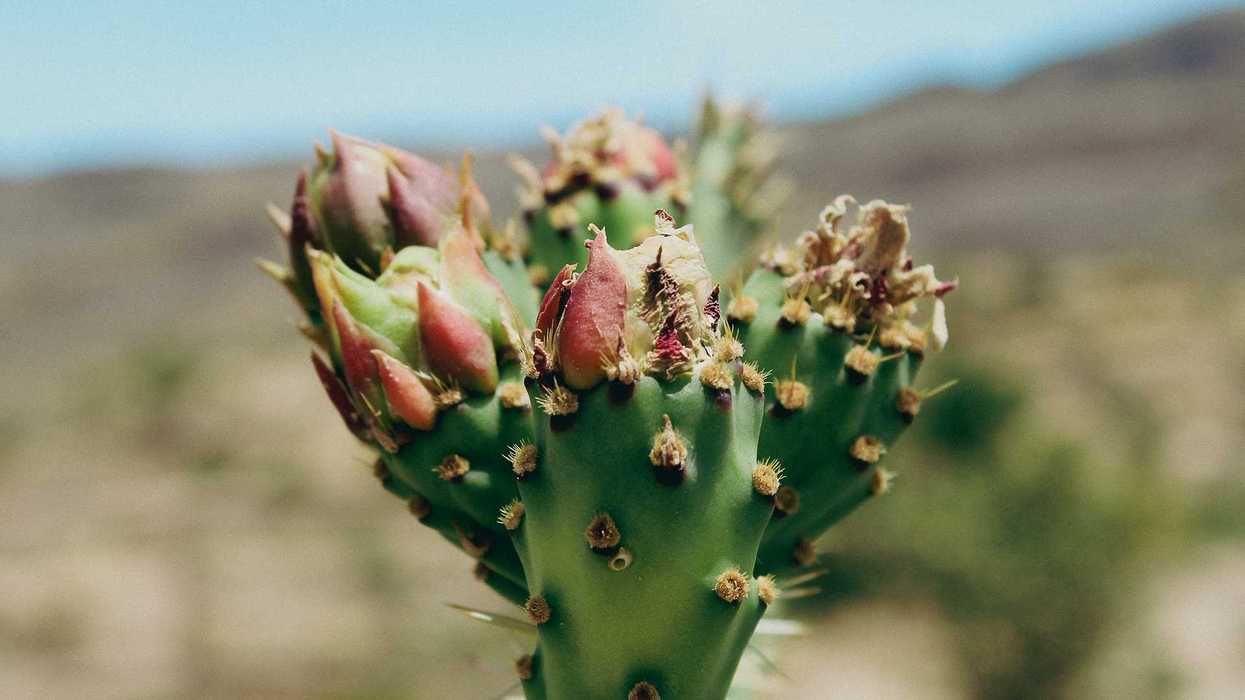
Otherwise, continue east on Shea until you reach 87, follow the signs towards Payson, and prepare to begin your scenic drive in earnest. Arizona State Route 87 is the main road between the Valley of the Sun and Payson, where you can jump on a highway up to Winslow. It is one of the most beautiful high desert mountain drives in the country. You’ll wind through mountains that, depending on the rain patterns, have stands of saguaro or even some isolated woods of pine.
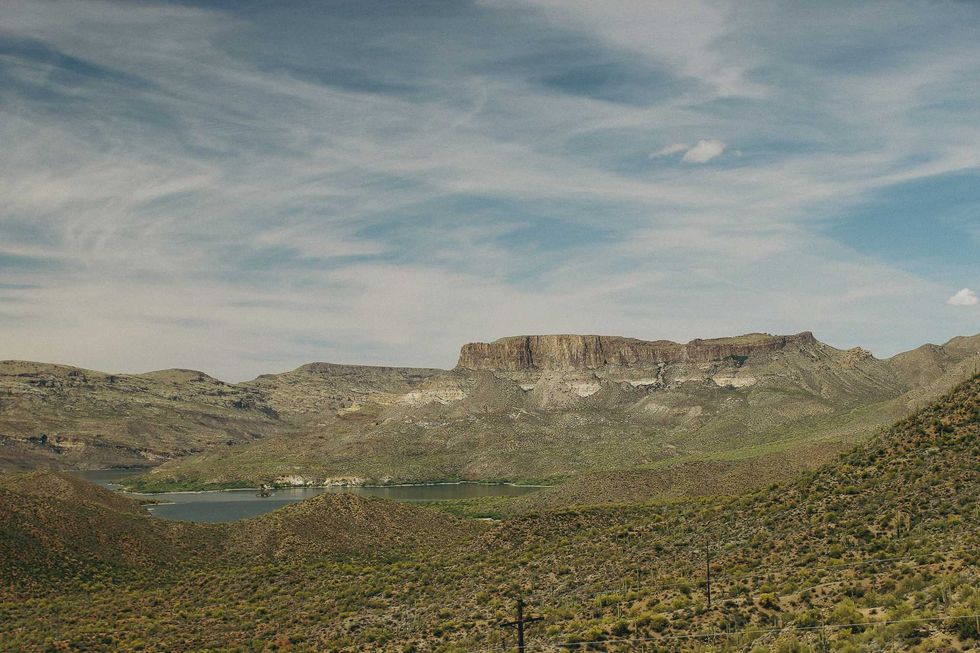
Take your time, pull off the road, and enjoy the scenery of the Tonto National Forest. About 50 miles into your drive, take the exit for State Route 188 towards Theodore Roosevelt Lake. Follow this road past the pastel-hued desert mountains until you reach the place the Apache Trail begins: Theodore Roosevelt Dam and its man-made reservoir.
Nearly a decade before Arizona joined the Union as the 48th state, the Salt River Project association was formed to help bring water to the growing Maricopa County and for the territory’s agriculture. The crowning achievement is the dam you see from the side of the road.
There are numerous activities surrounding the lake. Take some time to explore. But leave daylight to drive the trail. While the road is only about 27 miles, the low speed limit is going to mean you need a few hours to drive it. And even more to take in its wonder.
Former President Roosevelt dedicated the dam when it was completed in 1911. The Roosevelt Lake Bridge is breathtaking and makes a great photo.
 A pit stop on the road.
The Apache Trail was built as a construction road for the Salt River reclamation projects. The construction crews followed an ancient Apache Indian path. Sometime after construction, the road was numbered State Route 88 and opened to the public. The portion you are about to enter, between the Roosevelt Dam and Tortilla Flat, is unpaved. Throw the top down on your convertible and get your camera ready. You’re going to be stopping—a lot.
This is the white-knuckled part of your journey. You’ll drive through some of the most rugged terrain in the United States. The road, which narrows to barely one car width in some spots, hugs the side of the Superstition Mountains. Most of this treacherous path is without guardrails. With a speed limit of 15 miles per hour or less in most areas, adhering to it is essential.
While this is a challenging drive, you’ll be well rewarded. If you ever wondered what it would be like to drive down the side of the Grand Canyon, this must be it. Every turn brings an awe-inspiring view. While the trail often doesn’t make the lists of the most scenic drives in the country, it may be because it’s so tricky to navigate. When you finish the nearly 30 miles, you’ll be one of the few who have braved the road.
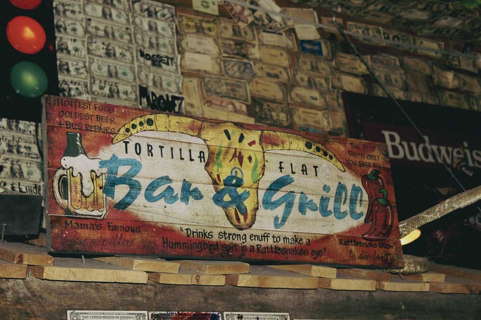
Near the end of the unpaved section of the trail, you’ll come onto Tortilla Flat, a small outpost with a country store and the magnificent Superstition Saloon. Grab yourself a drink and enjoy your accomplishment.
One of the most scenic drives in the country promises artistic and aesthetic transcendence.