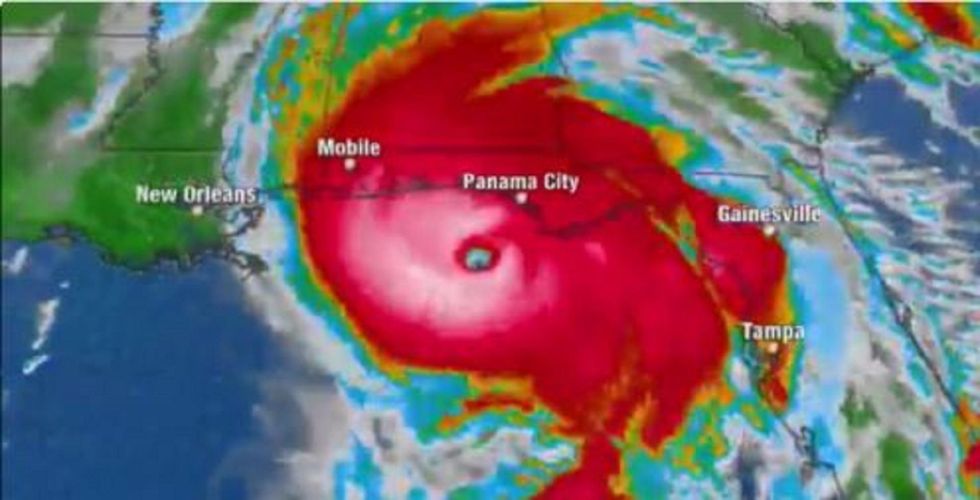
Hurricane Michael is a Category 4 storm approaching the Florida Gulf Coast. It could be the strongest hurricane to hit the Florida panhandle in recorded history. (Image source: Video screenshot)
Hurricane Michael has gained strength during its approach toward Florida's Gulf Shore and is expected to make landfall Wednesday afternoon. The storm is now a Category 4, which The Weather Channel warns will cause a "catastrophic storm surge."
If Hurricane Michael makes landfall as a Category 4 storm, it would be the strongest hurricane to hit the Florida Panhandle in recorded history, according to Colorado State University meteorologist Dr. Phil Klotzbach.
#Hurricane #Michael is now forecast by the National Hurricane Center to reach Category 4 strength as it heads towards the Florida Panhandle. 0 Category 4-5 hurricanes on record (since 1851) have made landfall in the Florida Panhandle. pic.twitter.com/WwKSWY8FHf
— Philip Klotzbach (@philklotzbach) October 10, 2018
At around 9 a.m. ET, Klotzbach reported that Michael had max sustained winds of 145 miles per hour, which is faster than any to reach the area since measurements began in 1851.
#Hurricane #Michael currently has max sustained winds of 145 mph. The strongest (based on max wind) hurricanes on record (since 1851) to make landfall in the Florida Panhandle had max sustained winds of 125 mph (Pensacola-1882, Eloise-1975). pic.twitter.com/W4DQ3MtZYA
— Philip Klotzbach (@philklotzbach) October 10, 2018
The National Hurricane Center has issued a storm surge warning for portions of the coasts of the Florida Panhandle, Big Bend, and Nature Coast. NHC said those areas will likely experience a "life-threatening" storm surge, where 9 to 13 feet of inundation is possible in the worst areas between Tyndall Air Force Base and Keaton Beach.
A Storm Surge Warning remains in effect for much of the Florida Panhandle and Big Bend region, where life-threatening storm surge is expected today. Storm surge inundation could reach 9 to 13 feet above ground level between Tyndall Air Force Base and Keaton Beach FL @NHC_Surge pic.twitter.com/7GZU8Ceq3y
— National Hurricane Center (@NHC_Atlantic) October 10, 2018
Hurricane Michael is also expected to produce potentially catastrophic wind damage, along with flash flooding and could spur tornadoes inland. The path of the storm is projected to hit several southeastern states, including Florida, Alabama, Georgia, and the Carolinas — many parts of which are still recovering from the damage caused by Hurricane Florence last month.
Hurricane #Michael. In addition to the life-threatening storm surge and wind impacts, heavy rainfall is expected across a large portion of the southeastern U.S. along Michael's track. These heavy rains are expected to extend well inland. pic.twitter.com/cUlAtrFTDC
— National Hurricane Center (@NHC_Atlantic) October 10, 2018
Florida Gov. Rick Scott warned early Wednesday morning that anyone who remained in evacuation areas should take cover, saying the time for evacuation had "come and gone."
The time for evacuating along the coast has come and gone. First responders will not be able to come out in the middle of the storm. If you chose to stay in an evacuation zone, you must SEEK REFUGE IMMEDIATELY.
— Rick Scott (@FLGovScott) October 10, 2018