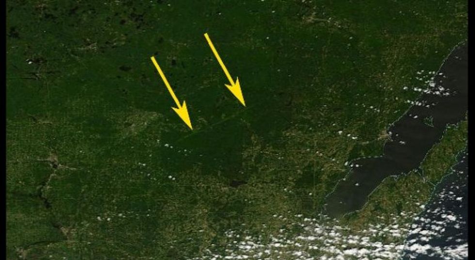
The damage a 2007 EF3 tornado did along a 40-mile-long path in Wisconsin is still visible from space. (Image source: NASA via Weather Channel)
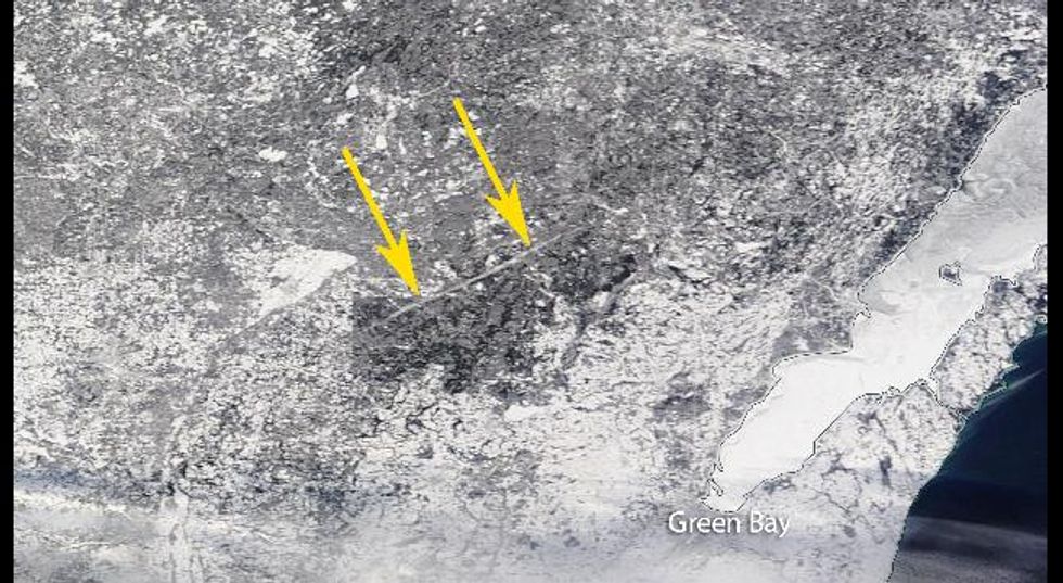
Take a close look at the following image captured recently from NASA's Terra satellite.
Do you see an odd line west of Green Bay?
 The damage a 2007 EF3 tornado did along a 40-mile-long path in Wisconsin is still visible from space. (Image source: NASA via Weather Channel)
According to the Weather Channel, the peculiar line visible from space is actually a scar left from a tornado that pummeled the area more than seven years ago.
The image, captured on Jan. 10, shows the damage the EF3 tornado did to the area.
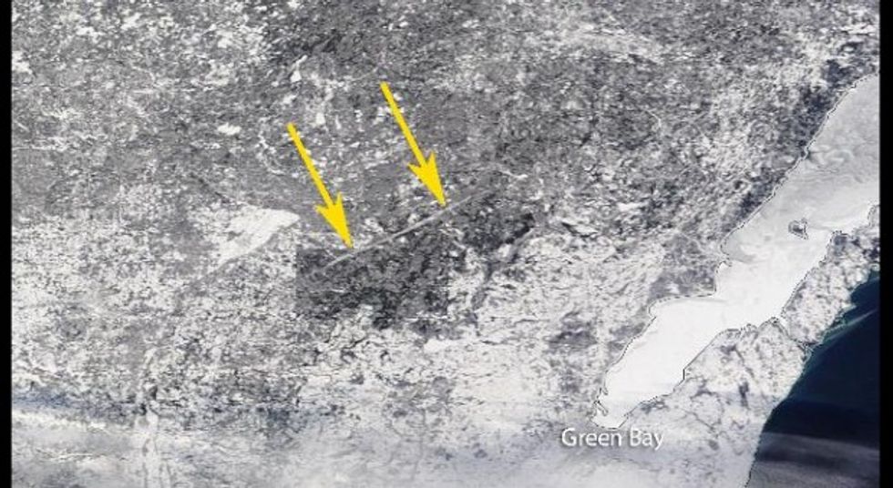
Here's another image, taken just two days after the tornado struck the area:
 The damage a 2007 EF3 tornado did along a 40-mile-long path in Wisconsin is seen from space two days after the storm rolled through the area. (Image source: NASA via Weather Channel)
The storm was responsible for destroying more than 14,000 trees along a 40-mile-long path on June 7, 2007, according to the Weather Channel.
The damage caused by the tornado is more visible in the winter because the exposed path shows up white when snow falls on the ground.
—
Follow Oliver Darcy (@oliverdarcy) on Twitter